NASA ISS Crew Captures Lake Pelku in Orbital Earth Observation Push
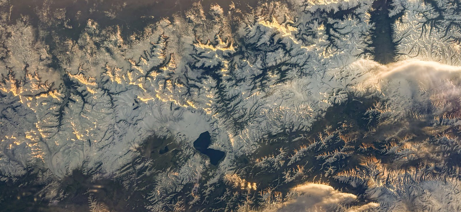
An astronaut aboard the ISS photographed Lake Pelku, highlighting the vital role of crew-operated orbital platforms in global environmental monitoring.
EXECUTIVE BRIEF // KEY TAKEAWAYS
An astronaut aboard the ISS photographed Lake Pelku, highlighting the vital role of crew-operated orbital platforms in global environmental monitoring.
An astronaut operating aboard the International Space Station has captured a striking photograph of Lake Pelku while traversing over the Asian landmass, providing vital orbital documentation of remote inland hydrologic features. The imaging event, announced by NASA, highlights the ongoing operational deployment of low-Earth orbit orbital outposts to record dynamic environmental phenomena with high-fidelity, crew-directed optical equipment.
The acquisition of targeted visual data over remote aquatic features carries far-reaching significance for international hydrological research, ecological risk analysis, and frontier remote-sensing programs. As commercial Earth observation satellite networks expand their footprint across commercial markets, human-tended orbital observation continues to deliver bespoke visual intelligence that complements programmatic automated imagery, supporting baseline natural resource assessments across vulnerable watershed basins.
Contextual Background and Orbital Observation Infrastructure
Lake Pelku, situated within central Asian topography, was photographed near the center of the orbital field of view as the station crossed regional airspace. The viewing geometry and solar illumination angle permitted detailed visual demarcation of the water body against surrounding terrain, yielding an asset that records geographical and limnological characteristics with spatial precision.
"The International Space Station serves as a unique platform for observing Earth with both hands-on and automated equipment," NASA stated in its official documentation.
Crew members aboard the station have produced hundreds of thousands of images over more than two decades of sustained human presence in microgravity. According to NASA News Releases, these specialized photographic surveys capture changing planetary conditions in real time, leveraging handheld professional-grade digital cameras equipped with long focal-length lenses. This operational flexibility allows astronauts to frame ephemeral atmospheric and terrestrial events that fixed-swath, sun-synchronous satellites may miss due to rigid orbital passes and nadir-pointing configurations.
Operational Impact on Global Earth Observation and Hydrographic Metrics
The technical integration of crew Earth observations into broader scientific archives strengthens the empirical foundation used by climatologists, cartographers, and civil protection authorities. Unlike autonomous multispectral sensors operating with predetermined revisit cycles, crew-operated photography captures variations in sun glint, oblique perspectives, and rapid environmental shifts. These datasets directly feed into publicly accessible planetary archives, where hundreds of thousands of individual frames serve as historical baselines for tracking surface water shrinkage, sediment transport, and land-use modifications.
From an enterprise and policy perspective, the economic utility of free, high-resolution orbital imagery is substantial. Downstream environmental analytics platforms integrate these cross-calibrated images into spatial models, reducing overhead costs for global institutions monitoring transboundary freshwater basins. For developing economies that lack indigenous orbital surveillance constellations, public repositories maintained by space exploration agencies provide continuous, no-cost verification of regional hydrological changes and environmental shifts.
Strategic Outlook and Next-Generation Frontier Platforms
As the International Space Station approaches its final operational decade ahead of planned low-Earth orbit commercial transitions, space agencies and commercial space station developers face strategic decisions regarding the preservation of crew-directed observational capabilities. Successor orbital complexes, whether private microgravity stations or automated free-flying imaging satellites, must determine whether to maintain astronaut-driven Earth photography programs alongside algorithmic sensor suites.
In the near term, NASA’s sustained publication of orbital imagery like the Lake Pelku frame reinforces the strategic imperative of multi-tier Earth monitoring architectures. As international environmental frameworks place heightened scrutiny on freshwater conservation and regional ecosystem resilience, the synthesis of orbital human reconnaissance, automated orbital constellations, and in-situ field validation will remain foundational to global geospatial intelligence and scientific governance.