How Gemini XII Crew Photography Sparked Modern Earth Observation
NASA highlights how 1966 orbital imagery captured by James Lovell and Buzz Aldrin laid the operational foundation for space-based Earth monitoring.
EXECUTIVE BRIEF // KEY TAKEAWAYS
NASA highlights how 1966 orbital imagery captured by James Lovell and Buzz Aldrin laid the operational foundation for space-based Earth monitoring.
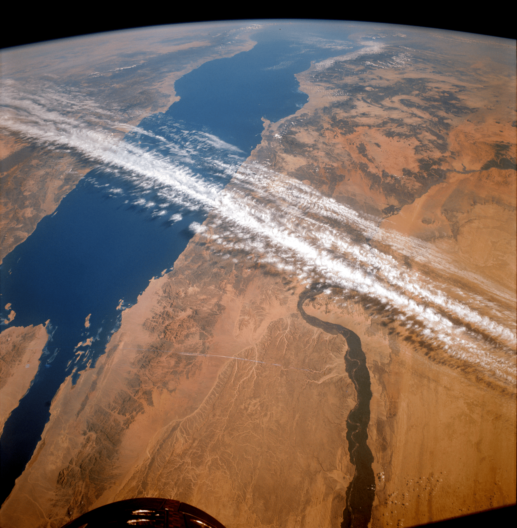
According to NASA News Releases, the November 1966 flight of Gemini XII—crewed by astronauts James A. Lovell Jr. and Edwin E. "Buzz" Aldrin Jr.—did far more than finalize the orbital rendezvous and extravehicular procedures needed for lunar exploration. Operating in low-Earth orbit from Nov. 11 to Nov. 15, 1966, during the concluding mission of NASA's Gemini program, the two astronauts captured handheld synoptic photography of Earth's surface that directly catalyzed the creation of systematic space-based Earth observation programs.
The historical retrospection from NASA underscores how early crewed spaceflight unintentionally generated one of the aerospace sector's most enduring scientific and commercial utilities: satellite remote sensing. What began as crew-operated photography aboard Gemini spacecraft rapidly proved to federal geological, agricultural, and oceanographic agencies that orbital vantage points offered analytical fidelity impossible to replicate through conventional aerial surveys. Today, that foundational proof-of-concept underpins a multibillion-dollar global Earth observation architecture critical to climate diagnostics, resource management, and supply chain intelligence.
From Lunar Proving Ground to Terrestrial Laboratory
As detailed in NASA's archival documentation, the primary mandate of the Gemini XII mission centered on resolving technical hurdles prior to the Apollo program. Lovell and Aldrin were tasked with executing precise orbital rendezvous maneuvers and demonstrating that astronauts could perform sustained, productive extravehicular activity (EVA), or spacewalks, without the debilitating physical exhaustion that had complicated earlier Gemini flights.
Alongside those engineering milestones, however, the crew conducted targeted photographic experiments looking back at Earth. Using modified medium-format cameras through the spacecraft windows, Lovell and Aldrin documented large-scale geological structures, coastal sediment patterns, and atmospheric phenomena across multiple orbital passes. Because orbital photography captured vast geographic expanses under uniform lighting conditions in a single frame, researchers on the ground were able to analyze continental-scale tectonic and hydrological features that previously required stitching together ratusan of disparate high-altitude aircraft photographs.
Catalyzing Institutional Remote Sensing Architecture
The operational impact of the Gemini photography portfolio reverberated across United States civil science agencies almost immediately after splashdown. By demonstrating the practical utility of multispectral and color orbital imagery, the Gemini XII photographs provided empirical justification for dedicated, uncrewed remote sensing satellites.
Within the federal research ecosystem, the clarity and synoptic breadth of the images collected between Nov. 11 and Nov. 15, 1966, accelerated inter-agency collaboration between NASA and the Department of the Interior. Scientists recognized that continuous orbital monitoring could track agricultural crop health, map uncharted mineral deposits, monitor coastal erosion, and assess hydrological basins in near-real time. Rather than viewing Earth imagery as a secondary byproduct of human spaceflight, mission planners began treating terrestrial observation as a core operational discipline requiring dedicated sensor payloads, standardized spectral bands, and automated telemetry downlinks.
Strategic Legacy and Forward Outlook
Nearly six decades after Gemini XII concluded the Gemini program, the duality of human exploration and terrestrial monitoring remains central to space agency strategy and commercial aerospace investment. While modern autonomous constellations now deliver high-revisit hyperspectral, synthetic aperture radar, and thermal imagery at sub-meter resolution, astronaut handheld photography from low-Earth orbit continues aboard the International Space Station, providing variable-angle, human-curated imagery of dynamic natural disasters and environmental shifts.
Looking ahead, the lineage traced by NASA from Lovell and Aldrin's 1966 mission informs next-generation orbital infrastructure. As space agencies and commercial operators deploy advanced Earth System Observatory missions and transition low-Earth orbit operations toward commercial space stations, integrating human-in-the-loop observation with automated sensor networks remains a vital methodology for validating climate models, calibrating orbital instruments, and preserving a continuous visual record of planetary change.